PANAMA: Region by Region
Welcome to our Region by Region section. This section is intended to provide more details of each county’s regions, highlighting the region’s attributes and points of interest, including what to see, best time to see it; suggested length of stay, and more. Moreover, this section provides the independent traveler the opportunity to consider what cities and regions interest them most. While our Pre-designed tour menu provides a wide range of suggested popular tour programs, the Region by Region sections allows you to custom-design the tour of your choice.
Panama City & Panama Canal
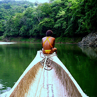
Overview
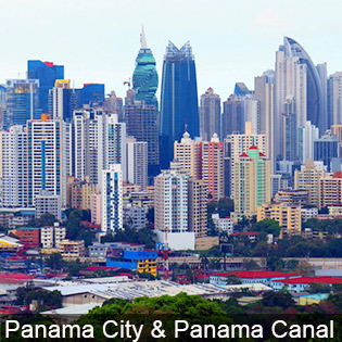
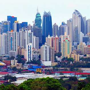
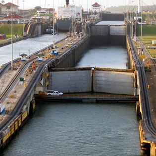
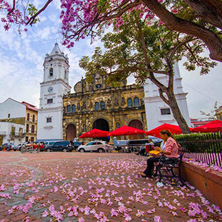
Panama City, capital city of Panama, is a fascinating blend of new and old. A vibrant cosmopolitan city, a center of international banking and trade, the sultry skyline of shimmering glass and steel towers is reminiscent of Miami. In contrast, the colonial peninsula of Casco Viejo has become a hip neighborhood where cobblestones link boutique hotels with rooftop bars and crumbled ruins with pirate lore. Together they are the gateway to tropical escapes. You can take a stroll through Cinta Costera contemplating the beauty of the modern city, and you can discover the history and entertainment of Casco Viejo (also known as Casco Antiguo or San Felipe), famed for colonial-era landmarks like the neoclassical Palacio Presidencial and bougainvillea-filled plazas lined with cafes and bars. A top the Canal the Miraflores Locks offers views of ships traversing the canal, an essential shipping route linking the Atlantic and Pacific. To the west, the Amador Causeway (Calzada de Amador) marking the entrance to the canal and the former Canal Zone, comprised of the causeway and the town of Balboa, a district of Panama City located at the Pacific entrance to the Panama Canal. East along the bay from the old city Centre, the pulsing and chaotic commercial heart of the capital lies in the neighboring districts of Bella Vista, El Cangrejo and Punta Paitilla, where the majority of banks, hotels, restaurants, shops and luxurious private residences can be found. Further east again, amid sprawling suburban slums, stand the ruins of Panamá Viejo, also known as Panamá la Vieja, the remaining part of the old Panama City. A mere 45-minute drive beyond the urban streets of Panama City you find dense tropical rainforest, rivers, and indigenous Indians.
Recommended Stay
Two to Five nights
When to go
Panama is a year-round destination. The driest part of the year runs between January and mid-April and considered the optimum time to visit Panama. If you’re not bothered by a bit of rain, consider travel during the rest of the year offering best. Temperatures remain at a fairly constant high throughout the year, staying at an average of 30 C (86 F). On the Caribbean coast, there are short, heavy bursts of rain almost daily, while the Pacific coast has a pronounced wet season from May to November.
Highlights
- Panama Canal: The Panama Canal is an artificial 82 km waterway in Panama that connects the Atlantic Ocean with the Pacific Ocean. The canal cuts across the Isthmus of Panama and is a conduit for maritime trade.
- Panama Canal Visitor Center: The visitor center offers the 3D projection of a film that introduces Mr. Canales, a character that will guide you through the history of the Panama Canal from its beginnings to the present. The film is available in English and Spanish, and with several show times and you can enjoy it in an air conditioned room with comfortable seats.
- Casco Viejo: Also known as Casco Antiguo or San Felipe, is the historic district of Panama City. Completed and settled in 1673, it was built following the near-total destruction of the original Panamá.
- Panamá Viejo: Also known as Panamá la Vieja, is the remaining part of the old Panama City and former capital of the country. It is located in the suburbs of the modern city.
- Ancon Hill: Ancon Hill is a 654-foot hill that overlooks Panama City, Panama, adjacent to the township of Ancón. Ancón Hill is an area in Panama that was used for administration of the Panama Canal.
- Chagres National Park: The Chagres River and the Alajuela Lake are its main attraction, in addition the historic Camino Real runs through the park. The Camino Real was used by the Spanish to transport gold from Peru and other South American countries from Panama City to Portobello on the Caribbean. At the top of Alajuela Lake there is a settlement of Embera Indians who moved here from the Bayano and Darien forests.
Colón & Central Caribbean
Overview
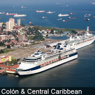
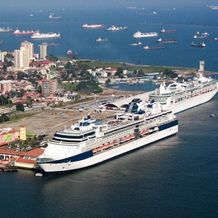
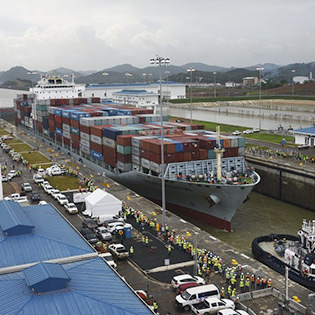
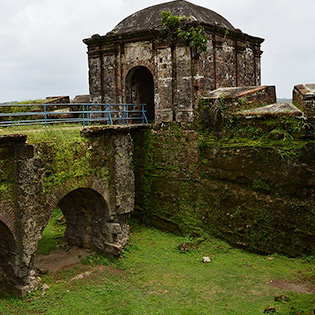
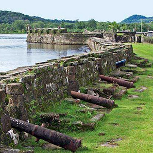
Colón is the capital of Colón Province, and the second largest city in Panama. It sits on the Caribbean coast, at the entrance to the Panama Canal. The Canal Expansion Observation Center is a park with viewing platforms over the canal’s Atlantic locks and Gatún Lake. Just west of the city, at the mouth of the Chagres River, Fort San Lorenzo is a fine examples of 17th- and 18th-century military architecture. The city was founded in 1850 by Americans working on the Panama railroad and was named Aspinwall after one of the builders of the railway until 1890. Colón is the Spanish form of Columbus; the name of the neighboring port of Cristsbal is Spanish for Christopher. Built on a swampy island, the city was notoriously unhealthful and often scourged by yellow fever until Colonel William C. Gorgas, in charge of sanitation during the canal construction, gave it a new system of waterworks and sewerage and drained the surrounding swamps. The famous beauty of its landscapes, its exuberant beaches, its historical route with multiple fortresses, canyons and stories of pirates, its exquisite cuisine, the diversity of races and colorful culture, the warmth of its people and its international shopping center (the Colon Free Zone), are some of the attractions that will surprise you when visiting Colón.
Recommended Stay
One to two nights
When to go
Panama is a year-round destination. The driest part of the year runs between January and mid-April and considered the optimum time to visit Panama. If you’re not bothered by a bit of rain, consider travel during the rest of the year offering best. Temperatures remain at a fairly constant high throughout the year, staying at an average of 30 C (86 F). On the Caribbean coast, there are short, heavy bursts of rain almost daily, while the Pacific coast has a pronounced wet season from May to November.
Highlights
- Gatun Locks: The Gatun Locks located some 6 miles south of Colon are an impressive site, lifting ships 85 feet above the Atlantic and Caribbean Sea. The total length of locks including the approach walls is nearly 2 miles long, and consists of three separate chambers. These are the first set of locks you encounter from the Atlantic side of the canal.
- Chagres and Fort San Lorenzo: Chagres, once the chief Atlantic port on the isthmus of Panama, is now an abandoned (not so well-kept) village at the historical site of Fort San Lorenzo. This is a great examples of 17th- and 18th-century military architecture, these Panamanian forts on the Caribbean coast form part of the defence system built by the Spanish Crown to protect transatlantic trade.
- Panama Canal Railway: The Panama Canal Railway Company is a transcontinental railway that runs from Colon to Panama City. The train has been in operation since 1855. The total travel time between the two cities is only one hour each way. If have the time, a ride is well worth it. The luxurious coaches have been restored and feature carpeted floors, wooden blinds, bathrooms, a bar and air conditioning. The train rides alongside the coast, offering unobstructed views of the ocean, mountains and bridges in its way.
- Shopping: Colon has one of the largest duty-free zones in the world. Avenida Central is the best destination if you’re looking for local items and cheap prices
Pacific Coast Beaches & Azuero Peninsula
Overview
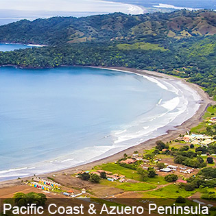
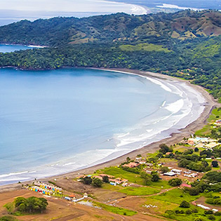
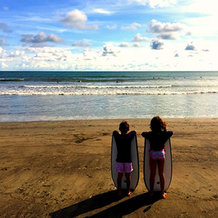
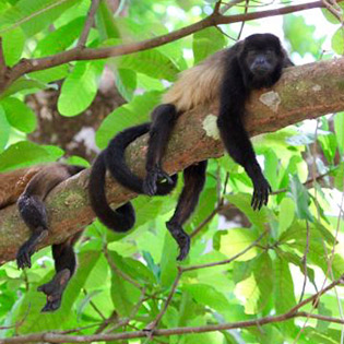
The Azuero is a large peninsula located in the south of Panama. Cultivated over 10,000 years ago, it was one of the first parts of the country to be settled, before the arrival of the Spaniards. The peninsula is often referred to as the “heartland” of the country, upholding traditions of farming, culture, and celebration. It is also home to one of Panama’s most secluded national Parks, Cerro Hoya. The Azuero peninsula is divided into three provinces: Herrera, Los Santos (both of which are entirely on the peninsula) and Veraguas, which extends into the west of the peninsula. It is surrounded by the Pacific Ocean on the south, the Pacific and Gulf of Montijo to the west, and the Gulf of Panama on the east. The peninsula is essentially divided into two regions: east and west. The eastern Azuero is best known for their Carnival celebrations that take place annually in Las Tablas. Other highlights in the region include Pedasi, a small but culturally rich fishing town, and the growing surf towns of Playa Venao and Cambutal. The western Azuero, known for farming, beaches and beautiful sunsets, is also developing quickly. The western coastline stretches along 70 km of pristine beach and is home to several towns including Mariato, Torio and Morrillio. These areas have also become popular pacific surf destinations. Further down the coast is Punta Duarte, offering some truly breathtaking ocean views.
Recommended Stay
One to two nightsWhen to go
Panama is a year-round destination. The driest part of the year runs between January and mid-April and considered the optimum time to visit Panama. If you’re not bothered by a bit of rain, consider travel during the rest of the year offering best. Temperatures remain at a fairly constant high throughout the year, staying at an average of 30 C (86 F). On the Caribbean coast, there are short, heavy bursts of rain almost daily, while the Pacific coast has a pronounced wet season from May to November.Highlights
- Pedasi: The tiny town of Pedasí is slowly emerging as one of Panama’s up-and-coming tourist destinations. Located in the southeastern corner of the Azuero Peninsula, it is tidy, charming, and friendly with buildings decorated with some wonderfully intact Spanish-colonial architecture, offering a number of pristine beaches close to town. Visitors to Pedasí can take trips to the wildlife sanctuary of Isla Iguana, which lays just off the coast, or head down the Azuero 34 km to the surf-haven of Playa Venao.
- Chitré: Chitré, capital of the Herrera province, is the largest city on the Azuero Peninsula. For most, Chitré serves as a convenient place to refuel or transfer buses before heading down the peninsula, as there is an ample amount of stores, restaurants, and accommodations in town. However, Chitré also has a vibrant Azuero culture and a history of its own, with a sprinkling of places that visitors will find attractive.
- Playa Venao: Playa Venao is a locally famous surf spot 34 km southwest of Pedasí. Playa Venao has hands-down the Azuero Peninsula’s best surfing, with waves breaking in both directions that are perfect for every skill level. The grey-sand beach here is pleasant, extending in a huge arc and surrounded by a curvy hillside. At present, this area is relatively undeveloped, but it is beginning to see a boom of projects as the word gets out about its laid-back vibe and awesome surf.
- Playa Cambutal: Playa Cambutal is a laid-back beach town on the southern Azuero Peninsula. It’s most popular with surfers and deep-sea anglers, but its attractive coastline will appeal to most everyone.
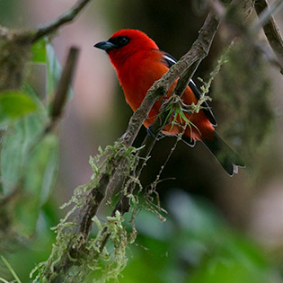
- Cerro Hoya National Park: Named after the peninsula’s highest peak, Cerro Hoya national park protects a wide range of plants and animals. More than 95 species of birds have been identified in the park, among them are the great green macaw and Azuero parakeet, a bird endemic to the area. The mountains are believed to have the same geological origin as Coiba, forming with the Galapagos about 80 million years ago, and then slowly drifting towards Panama.
- Farms and Forests: During this full-day tour, you’ll explore the highlands of Panama’s Herrera province. Along the way, you’ll visit family farms and hike in the El Montuoso Forest Reserve.
Chiriqui & Bocas del Toro
Overview
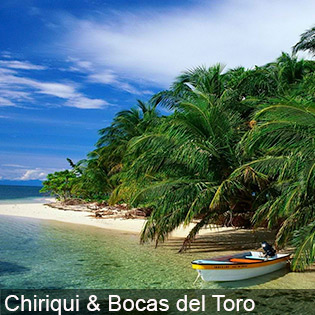
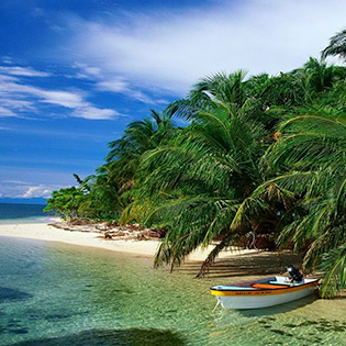
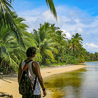
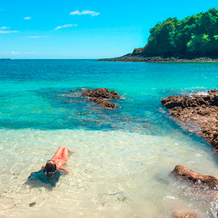
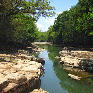
Chiriquí claims to have it all: Panama’s tallest mountains, longest rivers and most fertile valleys. The province is also home to spectacular highland rainforests and the most productive agricultural and cattle-ranching regions in the country. As a result, los chiricanos (natives of Chiriquí) take a particular pride in their province and wave the provincial flag – in every sense – at the slightest opportunity. It's also a land of immense beauty. On the coast, the pristine Golfo de Chiriquí boasts long sandy beaches and a rich diversity of marine life. The mist-covered mountains near the town of Boquete, a favorite of North American and European retirees, is a good base for adventures such as white-water rafting and hiking the flanks of Panama’s highest point, Volcán Barú (3474m). Boquete is also the center of Panama’s coffee industry, which means that a potent cup of shade-grown arabica is never more than a cafe away. Bocas del Toro is a province of Panama comprising an island chain off the Caribbean coast, plus a section of nearby mainland with biodiverse rainforest. Isla Colón, the main island, is home to the capital, Bocas Town, a central hub with restaurants, shops and nightlife. Popular beaches include Boca del Drago. Also on Isla Colón is Starfish Beach, named for the numerous sea stars on its ocean floor. Bocas serves as a convenient base for exploring the archipelago; taxis marinos (water taxis) can whisk you away to remote beaches and snorkeling sites for just a few dollars. The real allure here, though, is simply to be able to slow down and soak up the Caribbean vibes.
Recommended Stay
Three to Five nights
When to go
Panama is a year-round destination. The hottest months are March, February, and April. The warmest time of year is generally early to mid-March where highs are regularly around 94.4°F (34.7°C) with temperatures rarely dropping below 73.7°F (23.2°C) at night. The driest part of the year runs between January and mid-April and considered the optimum time to visit Panama.
Highlights
- Volcán Barú: The Volcán Barú is an active stratovolcano and the tallest mountain in Panama, at 3,475 metres high. It lies about 35 km off the border of Costa Rica.
- The Lost Waterfalls: The waterfalls are located in Boquete, a small town in the North of the Province of Chiriqui, along the slopes of the Baru Volcano and close to La Amistad International Park. Activities like hiking, coffee tours, river-rafting, horse-back riding, bird-watching and many others give our visitors the opportunity to experience firsthand the diversity of flora and fauna of the area as well as enjoying our coffee production, one of the finest in the world.
- Carenero Island: Carenero Island is a long and forested island located just a few hundred meters east of Isla Colón, in the Bocas del Toro Archipelago. This 232-acre island has no cars, offering serene beaches & waves for surfing enthusiasts.
- Starfish Beach: Starfish Beach (or “Playa Estrella”) is located on the remote, unexposed side of Isla Colón. The shoreline is shaped like a bay, so it doesn’t catch any swell – making for placid turquoise waters and a relaxed vibe.
- Isla Bastimentos National Marine Park: This is a marine park located in the Bocas del Toro District and archipelago of Bocas del Toro Province, Panama. Created in 1988, this is Panama's first national marine park.
- Scuba Diving: Scuba diving in Bocas Del Toro is a magical experience that no one should miss. With the names of the local dive sites such as Punta Caracol (seashell point), Punta Manglar (mangrove point) and Coral Gardens, it kind of paints a picture of what you can expect.
- Bocas Del Toro Catamaran Sailing: There are few activities more relaxing than a catamaran sailing adventure around Bocas Del Toro in Panama. This catamaran sailing tour is one you’ll definitely want to take part in, during which you will encounter destinations such as Starfish Beach where you will witness the amazing sight of giant starfish decorating the beach, and Dolphin Bay where baby dolphins can be seen frolicking around the turquoise-hued waters.
Darién Province
Overview
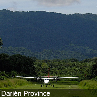
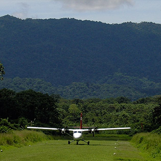
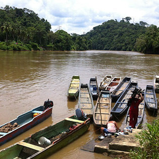
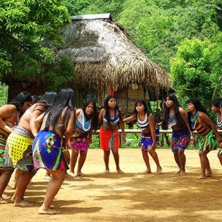
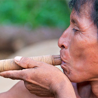
The Darién is a province in eastern Panama, partially bounded by Colombia and the Pacific Ocean. There are few places on Earth like the Darién. Since its introduction to the outside world, the Darién has piqued the interest of biologists, anthropologists, drug-runners, business owners, and even foreign nations. It is a place with immense beauty and incredible bounty, where the natural world is raw and the indigenous people real. It is Panama’s – and by some measure, the world’s – last frontier. This is home to a vast wilderness commonly called the "Darién Gap," which refers to the road less swathe of forest that's the "missing link" in the Pan-American Highway. Protected areas include Darién National Park, encompassing more than 500,000 hectares with serrated peaks, coastal lagoons and mangrove swamps. One of world’s richest biomes is the 5760-sq-km Parque Nacional Darién, where the primeval meets the present with scenery nearly unaltered from one million years ago. Even today in the Darién, the Emberá and Wounaan people maintain many of their traditional practices and retain generations-old knowledge of the rainforest. In a stroke of irony, much of the Darién has remained untouched because of its volatile reputation. The road to Yaviza – the most accessible part of the province – has scenes of habitat destruction. Cruising the waterways and hiking trails are the only ways to explore the slow-paced interior Darién and the Pacific coast, where Emberá, Wounaan and African-Darienita cultures coexist.
Recommended Stay
Three to Five nights
When to go
Panama is a year-round destination. The hottest months are March, February, and April. The warmest time of year is generally early to mid-March where highs are regularly around 94.4°F (34.7°C) with temperatures rarely dropping below 73.7°F (23.2°C) at night. The driest part of the year runs between January and mid-April and considered the optimum time to visit Panama.
Highlights
- Armila: Visitors must take a boat to visit the remote beaches of Armila. This shore has very strong currents and tall waves. Armila’s beach is located a short distance from the border with Colombia, in the Guna Yala province of Panama.
- Yaviza: Yaviza is a small, dilapidated town at the end of the Interamericana. This is where the highway ends and the notorious Darién Gap begins, which stretches some 60 miles (100 km) to the border with Colombia. Yaviza is not a place to visit, but rather a town to pass through as your make your way into other parts of the Darién.
- Santa Cruz de Cana: Santa Cruz de Cana is one of the most remote places in Panama. Set within the middle of the Darién National Park, Santa Cruz de Cana (more commonly known as Cana) offers travelers true wilderness. There are no roads here and the closest village, Boca de Cupe, is a 2–3 day hike.
- Punta Patiño Nature Reserve: The Punta Patiño Nature Reserve is the largest private reserve in Panama. Set along the Darién’s Pacific coast, Punta Patiño spreads across 74,132 acres (30,000 hectares) and includes huge swaths of primary and secondary forest. It has well-developed trails, great biodiversity, and sees very few visitors.
- Mogue: Mogue is an Emberá village in the Darién. It’s definitely an off-the-beaten-path destination, but travelers that make it here will be rewarded with a unique look at a fairly traditional Emberá village.
- La Palma: La Palma is the provincial capital of the Darién Province. It’s a small town, with fewer than 4,000 residents. Most travelers only stop here while en route to other destinations in the Darién.
- Piñas Bay: Piñas Bay (Bahía de Piñas) is set along Panama’s southern Pacific coast in the Darién Province, some 56 kilometers (35 miles) from the border with Colombia. Piñas Bay is Panama’s most incredible fishing spot—more than 200 deep-sea fishing world records have been set here, more than anywhere else on Earth. The area is also naturally beautiful and interesting culturally, so even non-fishers will find it a pleasant place to visit.

